


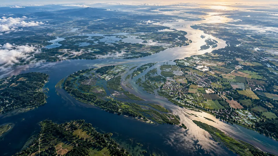
The sector challenge
An image becomes useful only when its meaning and limits are clear.
Satellite observations can provide wide-area information, but an attractive map alone does not establish accuracy or fitness for a decision. Sensor characteristics, acquisition timing, cloud cover, terrain and reference information can all affect what a result means.
Development starts with a user question, a defined geographical boundary and an observable indicator. Workstreams cover flood impact, wildfire assessment, agricultural conditions and water-resource monitoring, with data suitability and validation built into the analysis approach.
Programme development priorities
- Translate a societal question into observable indicators and data requirements.
- Develop an appropriately licensed, reproducible analysis workflow.
- Report uncertainty and validation limitations alongside any map or interpretation.
Technical scope & method
A structured approach to the question.
- 01Use-case and data design
- Specify the region, time window, intended decision and acceptable latency. Assess multispectral, radar and independent reference sources for coverage, licensing and suitability.
- 02Preprocessing and analysis
- Document quality screening, spatial alignment and the sensor-specific corrections needed. Record classification, change-detection or indicator methods so that the result can be reproduced.
- 03Fusion and validation
- Where useful, combine complementary observations without treating different resolutions as equivalent. Compare outputs with independent reference information and record sampling limitations.
- 04Decision-oriented reporting
- Explain spatial accuracy, detection performance, data latency and uncertainty in terms the intended user can assess. Distinguish observed conditions from inference.
- 01Observation sourcesMultispectral / radar / reference data
- 02Controlled workflowQuality checks and preprocessing
- 03Geospatial analysisIndicator or change assessment
- 04Validation and interpretationUncertainty, latency and limitations
Pilot development & application
One region, one flood-mapping question.
The geospatial development framework compares observations before and after a historical flood within a defined study area. It connects licensed imagery, independent reference information, documented preprocessing and a reproducible analytical method. Maps and interpretation are evaluated together with spatial uncertainty, coverage and data latency.
Define the use case
Select the area, event window, map scale and intended analytical question. Check the suitability and rights of available data.
Run a reproducible comparison
Record acquisition details, preprocessing, classification choices and quality exclusions. Preserve a versioned workflow and its assumptions.
Validate and explain
Assess detection and spatial performance against independent information, identify omitted or ambiguous areas and report limits on operational use.
Development connects a defined application, measurable criteria and a traceable technical review.
Technical deliverables
Outputs and evaluation.
The development workstreams connect these deliverables to reviewable evidence and application-specific evaluation criteria.
- Use-case requirements
- Data-source assessment
- Reproducible geospatial workflow
- Pilot map and technical interpretation
- Uncertainty and validation assessment
- Findings and limitations report
Evaluation priorities
- Analytical performance
- Spatial accuracy and detection behavior against suitable reference information.
- Timeliness and coverage
- Acquisition gaps, processing latency and the extent of usable observations.
- Practical usability
- Whether a reader understands what the map supports and what it cannot establish.
Participation & boundaries
The right expertise. Clear responsibilities.
The participation framework connects remote-sensing research, geospatial analysis, application-domain expertise and user needs. Technical contributions are organized around data quality, reproducibility, validation and the interpretation needed for a decision.
Scope and safeguards
Data licensing, authorized use and proportionate review of sensitive location information are part of the analytical workflow. Source, acquisition and processing records support reproducibility.
Research interpretation and authorized emergency-management products serve different purposes. Operational decisions require the relevant competent authority, validated information and an appropriate service context.
Participation and technical decisions remain separate.
Participation does not automatically confer membership rights, AF Recognition, accreditation, certification, standards-setting authority or procurement preference. Sponsorship must not determine technical conclusions, evaluation results or governance decisions.
Development pathway
Development, grounded in evidence.
Technical objectives, responsible coordination and application needs shape the development process. Resources, safety, confidentiality, data protection, intellectual property and reporting arrangements are reviewed alongside the methods and deliverables, keeping progress focused and accountable.
A structured development pathwayExplore the seven connected development stages
Programme development connects technical requirements, responsible coordination and reviewable evidence. Each stage informs the next, while review findings refine the scope, methods and priorities.
- Requirements & Objectives
Define the technical problem, user need and scope.
- Feasibility & Evidence
Examine methods, resources, interfaces and dependencies.
- Scope & Responsibilities
Align workstreams, coordination and review arrangements.
- Pilot Development
Connect the evaluation plan to funding, safety, data and intellectual-property controls.
- Controlled Implementation
Maintain the agreed technical boundary and responsible delivery arrangements.
- Technical Evaluation
Review evidence and outcomes against application-specific criteria.
- Knowledge & Further Development
Translate reviewed findings into useful outputs and the next development priorities.